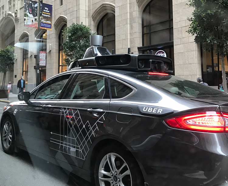
Almost every day, I read about a new driverless car or truck, a new driverless test, a city’s efforts to get ‘smarter.’ Recently I attended the ITS World Congress in Montreal, where global leaders in transportation show and evaluate the latest innovative concepts, active prototypes, and live systems. I saw an abundance of grandiose ideas of how we will all get around in the not-so-distant future.
As exciting as those technology-driven ideas are, what is noticeably lacking in the North American discussion is any mention of the digital location infrastructure required to make these ideas viable. For instance, a driverless vehicle needs to know in advance when a road is closed for maintenance or sewer repairs.
Today vehicles are littered with sensors that allow it to interpret its surroundings, and we’ve come to depend on these fast, reliable sensors to keep us safe. They tell drivers how close other vehicles are and will engage the brakes if you don’t. They nudge you back into the right lane when you drift. They let you know that something’s in your blind spot.
In the future, the car will use lidar (light radar) to know exactly what is in your blind spot. It will swerve to miss a tree you can’t see in the blinding snow. It will brake if what in front of you is not a too close car, but a person.
Driverless vehicles will need even more. They require a large array of infrastructure-based communication assets to relay data to all vehicles in the vicinity, in order to drive safely. These vehicles need to know when the traffic light will be changing, the position and speed of an approaching emergency vehicle, and any disruption beyond the range of the vehicle’s sensors.
Imagine the problems if those vehicles are relying on outdated maps or using an unreliable GPS system. We’ve all experienced the inconvenience of a GPS-based navigation system showing something is a field when in fact, since that data was entered, it has become a developed community. Both the style of operation of autonomous vehicles and our own increasing demands require authentic and reliable data.
Autonomous vehicles need a highly detailed and constantly updated map provided by the local authoritative source in order to make sound decisions. Gone are the days of static, outdated maps. Today, an outdated map is more than just an inconvenience; it is a safety hazard.
The connected cars of tomorrow will be making millisecond decisions about how to react to live road conditions, other vehicles and errant pedestrians. With the amount of current transportation infrastructure development in both urban and rural areas, current information on any changes or updates will be a prerequisite for connected cars. More importantly, changes to the data must come from a trusted, authoritative source that can be interpreted from all vehicles regardless of brand.
Most Canadian cities today manage their municipal assets within a modern geographic information system. This data is typically considered authoritative and highly accurate. We will all need the same level of comfort from a common and trusted source so that our connected cars of the future know what the lane geometry of the upcoming intersection is, the height clearance of all the bridges on a planned truck route and of course, the location and status of upcoming roadwork projects.
The future landscape of firms providing sensor data and ‘smarts’ to our cars is certainly going to be exciting. But the foundation of our digital transportation infrastructure rests in the hands of Canadian municipalities, many of which already have the technology to begin serving the data to support our future transportation systems. The question is: are they getting ready?
Arif K. Rafiq is a transportation professional, consulting with federal, state and provincial governments on best practices and methodologies for road infrastructure management. He is currently a subject matter expert for Esri Canada helping guide transportation practitioners on the effective use of GIS-based transportation systems.

